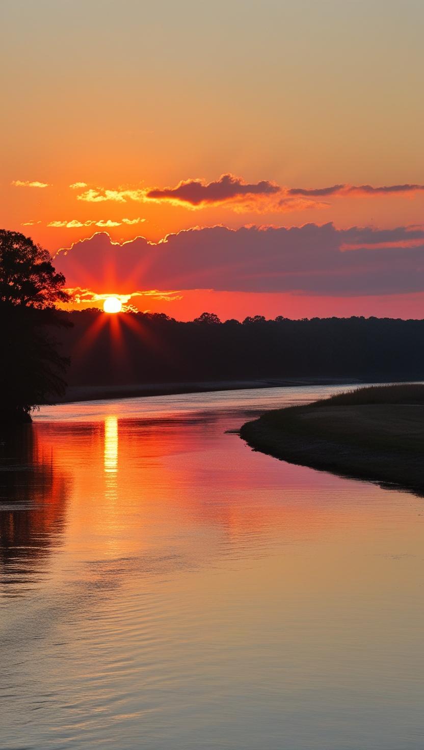
The Most Important Stretch of River in Georgia
If there is one stretch of the Chattahoochee tailwater that every serious angler in the metro Atlanta area should know intimately, it is the three miles of river immediately below Buford Dam. This is the headwaters of the trout fishery. The water is coldest here. The fish are most densely concentrated here. The environment is unlike anything else on the tailwater, and the fishing, when conditions are right, is as good as anything you will find on a tailwater river anywhere in the Southeast.
It is also the most dangerous stretch of the entire river, and I want to make sure you understand that before we talk about anything else.
I have been fishing this water for more than twenty years. I have guided beginners and experienced anglers through this section more times than I can count. I have watched people make mistakes that nearly cost them their lives, and I have stood on the bank and helped people out of the water after releases caught them off guard. The fishing below Buford Dam is worth every minute of effort it takes to do it right. But doing it right means understanding the risks and taking them seriously before you ever put on your waders.
Let’s start with safety. Everything else comes after.
Understanding the Water Release Schedule
Buford Dam exists to generate hydroelectric power, manage Lake Lanier’s water level, and provide downstream water supply. It does not exist to create a pleasant fishing experience, and the Army Corps of Engineers is not managing their generators around your float plans. The releases happen on their schedule, driven by power demand and water management needs, and the releases can transform the river below the dam in a matter of minutes.
Here is the basic pattern. The Corps of Engineers typically runs peak power generation releases on weekday afternoons, when electricity demand from the metro Atlanta grid is at its highest. The two large sixty-megawatt generators that produce the bulk of the dam’s output cycle on twice daily during peak demand periods. However — and I cannot stress this strongly enough — releases are not limited to weekday afternoons. Unscheduled releases can happen in the morning, on weekends, and at any time the Corps needs to manage lake levels or respond to unusual downstream demand. Weather events, drought conditions, storm inflows, and multi-state water management agreements can all trigger releases at unexpected times.
Normal low-flow conditions on the river below the dam run around 600 cubic feet per second. When the generators kick on during a full power release, that number can jump to well over 1,000 cubic feet per second. The river does not gradually ease up to those flows. It rises fast. Experienced anglers who have been on this river long enough have watched the water go from calm and fishable to dangerous in the time it takes to strip in your fly line and look upstream.
During a full release, the river can rise as much as eleven feet in a matter of minutes in the section closest to the dam. Eleven feet. If you are standing mid-thigh in the river and the water comes up eleven feet, you are not wading out. You are swimming, and the current at those flows is not something even a strong swimmer can manage comfortably, especially in water that is somewhere between 44 and 58 degrees Fahrenheit year-round.
How to Check the Release Schedule Every Single Time
I will tell you what I do. I check the schedule before I leave the house. I check it again in the parking lot before I walk to the river. And when I am on the water, I set an alarm on my phone or watch to go off fifteen minutes before any scheduled release so I have time to move to the bank well before the water comes up.
You have several tools available for checking the release schedule.
The most reliable method is the hotline. The Army Corps of Engineers maintains a recorded information line for Buford Dam at 770-945-1466. This line is updated regularly and gives you the current day’s generation schedule. Call it every time. No exceptions. It takes thirty seconds and it could save your life.
There is also a low-power AM radio station that broadcasts water release information continuously in the vicinity of the dam. Tune to 1610 AM and you will get current release information as long as you are within range of the signal, which covers the area closest to the dam.
The Corps also maintains an online schedule where you can look up generation plans by selecting Buford Dam and the current date from the dropdown menu on their water management website. This is useful for advance planning but remember that schedules can change, so always confirm with the hotline on the day you are fishing.
Additionally, four warning sirens are installed along the river between Buford Dam and the State Route 20 Bridge. These sirens activate approximately five minutes before a release begins. Releases happen within minutes of the sirens going silent. Five minutes sounds like enough time. It is not, if you are standing in the middle of the channel on slippery rocks fifty yards from the bank. Five minutes is your absolute last resort warning, not your primary safety plan.
Here is one more thing you need to know about those sirens. If you are fishing south of the State Route 20 Bridge, you may not be able to hear them. The further downstream you go, the less reliable the siren system becomes as your only warning. Below Highway 20, the release schedule and your own vigilance are your primary safety tools.
Water Temperature and Hypothermia
Even on a hot August day in Georgia, the water flowing out of the bottom of Lake Lanier is cold. Cold enough to shock your system if you fall in unexpectedly. The water temperature in the river immediately below the dam ranges from 44 to 58 degrees Fahrenheit year-round. At those temperatures, an unprotected person in the water will experience significant loss of motor function and the onset of hypothermia within thirty to sixty minutes. If you are fighting current, the timeline is shorter.
I wear neoprene or breathable waders with a wading jacket every time I fish this section, regardless of air temperature. On a ninety-degree July afternoon when it feels absurd to be wearing waders, I am still wearing them, because the water temperature does not change because the air is hot. If anything, the contrast between the air temperature and the water temperature makes a sudden unplanned immersion more dangerous, not less, because your body is not prepared for the shock.
If you are not wearing waders, stay out of the water above the Highway 20 Bridge. Bank fish, or come back when you have the right gear.
Life Jackets Are Not Optional Here
Between Buford Dam and the State Route 20 Bridge, wearing a personal flotation device while wading in the river is not a suggestion. It is a regulation. The National Park Service requires it. If you are wading in this section without a PFD, you are violating federal law, and more importantly, you are taking an unnecessary risk with your life.
I know that fly fishing in a life jacket feels awkward the first few times. Get over it. Wear it correctly, with the chest strap secured, not hanging loose around your waist. A PFD that is not fitted properly is barely better than no PFD at all. Inflatable PFDs work well for anglers because they provide full range of arm motion for casting while still deploying quickly in an emergency.
Even below Highway 20, where the PFD requirement is not legally mandated, I strongly recommend wearing one while wading. The release travel times mean that water released at the dam does not arrive at downstream access points instantly. By the time it gets there, it is moving with speed and volume that can surprise even experienced waders who think they know the river.
Here is a quick reference for how long it takes a release from the dam to affect downstream locations. From the dam to the Highway 20 Bridge is about 2.7 miles, and you have roughly 45 minutes before the initial rise reaches you, with the water staying elevated for about an hour and a half. Settles Bridge at 5.5 miles below the dam gives you about an hour and a half before the water rises, staying up for around three hours. The timing stretches further as you move downstream. These are approximate numbers that vary with the size of the release and the existing flow conditions, but they give you a framework for planning your day on any section of the upper tailwater.
Footing and Wading Staff
The riverbed immediately below the dam is one of the most treacherous wading surfaces I have encountered on any river in Georgia. The rocks directly below the dam are heavily scoured by regular releases and have very little algae growth, which might make you think they would offer decent footing. The reality is that the smooth, rounded cobble in this section is extremely slippery when wet, and wading in the swift current closest to the powerhouse requires careful, deliberate movement and both feet firmly planted before you shift your weight.
As you move downstream through the Bowman’s Island section, the river braids out and becomes shallower and more manageable, but the rocks remain slick throughout the upper tailwater. Felt-soled wading boots provide the best traction on smooth river rock and are my strong recommendation for anyone planning to wade this section. Add a wading staff and you have three points of contact in moving water instead of two, which can be the difference between a wet wade and a very bad day.
Never wade alone in this section. Always fish with a partner who is positioned to assist you if you lose your footing, and always make sure someone on shore knows where you are fishing and what time you are expected back.
The Trail System and Accessing the Water
Now that we have covered the safety fundamentals in the detail they deserve, let’s talk about how to actually get to the water and what you will find when you get there.
There are two primary access points for wading anglers fishing the section immediately below Buford Dam. Each offers a different experience and access to different water.
The first and most direct access is the Lower Pool area right below the dam itself. To reach it, take Buford Dam Road all the way to the end and park near the wooden fences that line the road. From here you are within a short walk of the tailout directly below the powerhouse. This is the coldest, swiftest, and most technical water on the entire tailwater. The current is powerful, the rocks are slick, and the fish hold tight in eddies and seams behind large boulders and in the deepest troughs. This section rewards technical fly fishing but is not the place to learn to wade if you are new to moving water.
A float tube is a useful option at this access point when flows are up, allowing you to position yourself on the water without trying to wade water that is simply too swift and deep to navigate on foot safely. When flows are low, careful wading is possible with proper gear and attention to footing.
The second and in my opinion more productive access point for most wading anglers is the Bowman’s Island area, accessed through the Buford Trout Hatchery. You park outside the hatchery gate along Trout Place Road and walk the Bowman’s Island Trail around the perimeter of the hatchery to reach the river behind it. This walk takes about twenty minutes at an easy pace and is itself a pleasant experience — the trail winds through wooded bottomland with views of the hatchery raceways before delivering you to the river.
Once you reach the back of the hatchery, the river changes character significantly from the water directly below the dam. Here the channel braids around Bowman’s Island, splitting into shallower runs with gravel and cobble bottom that are far more approachable for wading. The currents are more manageable, the footing is better, and you have room to wade out into the river and cover the productive water through the middle of the channel. This section also benefits from proximity to the hatchery — fish are stocked very close to here and tend to remain in this stretch in significant numbers.
The Bowman’s Island Trail continues along the river downstream, giving wading anglers access to additional water without having to return to the parking area. Walk the trail downstream, look for access points where the bank drops down to the river, and work the water you find rather than crowding into the most heavily pressured spots near the trailhead. The fish are spread throughout this section, and an angler willing to walk a quarter mile beyond where everyone else stopped will often find water that fishes far better simply because it sees less pressure.
One practical tip: arrive early. This section of river draws serious anglers from all over the metro area, and the most productive holes below the hatchery can fill up by mid-morning on a weekend. If you want the best water, be there when the fog is still on the river.
Downstream Wading Access: Highway 20 to Settles Bridge
As you move south of the Highway 20 Bridge, the character of the river shifts again. The Highway 20 access provides a parking area directly off the bridge with a trail that runs along the river in both directions. This section marks the beginning of the artificial lures only zone, which runs from Highway 20 downstream to the Medlock Bridge boat ramp just above Georgia 141.
The Highway 20 access and the Settles Bridge access downstream offer some of the best wading conditions on the entire tailwater. The river has spread out by this point, the bottom is a mix of gravel, cobble, and sandy shoals that are far more forgiving underfoot, and the current is generally manageable even during moderate flows. Aquatic insect populations improve significantly in this section, which matters a great deal for fly fishing because the bugs the fish are eating become more diverse and more predictable.
Settles Bridge is accessed via Johnson Road in Suwanee and offers trailhead parking, though there is no boat ramp — this is a wade-fishing and non-motorized watercraft only access point. The trails at Settles Bridge run along both banks and provide access to several hundred yards of excellent wading water in both directions from the bridge itself. This is one of my favorite sections of the entire tailwater for wade fishing, particularly in the fall when the water is low and clear and the fish are actively feeding in the shoals.
The Fishing: Fly Fishing on the Tailwater
Let’s talk about what works. Fly fishing the Chattahoochee tailwater is fundamentally a nymphing game, particularly in the upper sections closest to the dam. Understanding that is the first and most important thing I can tell any fly angler planning to fish this river.
Nymphing
The trout in this tailwater — both the stocked rainbows and the wild and holdover browns — spend the vast majority of their time feeding subsurface. The insect populations in cold tailwater like this are dominated by midges, with significant populations of blue-winged olive mayflies, caddis, little black stoneflies, and sowbugs depending on the season and location. Most of the time, most of the fish you are going to encounter are hanging in the water column, intercepting drifting food items rather than rising to the surface.
Nymphing under a strike indicator is the most reliable and productive technique for the majority of anglers on this water. Rig a nine-foot five-weight or six-weight rod with a leader extended to twelve or fourteen feet total, attach a small yarn or foam indicator at the depth appropriate for the water you are reading — typically one and a half to two times the water depth — and fish a tandem midge rig below it. The classic setup that has caught more Chattahoochee trout than any other is a midge pupa pattern as the top fly and a midge larva imitation as the bottom fly, with weight adjusted to get the flies ticking bottom.
The Zebra Midge is the most famous fly on this river, and it is famous for good reason. A size 18 or 20 Zebra Midge in black thread with a silver bead head will catch fish on the Chattahoochee tailwater on virtually any day, in virtually any conditions. It belongs in your box in multiple colors — black is the primary producer but red, olive, and rainbow variations all have their days. The Blue Assassin is another Hooch-specific pattern that has earned a devoted following among local anglers and is worth carrying. Pheasant tail nymphs in size 14 through 18, Hare’s Ear nymphs in the same size range, copper johns, rainbow warriors, and lightning bugs round out the core nymphing selection.
Euro nymphing — tight line nymphing without an indicator — is growing rapidly in popularity on this river among more experienced fly anglers. The technique allows extremely precise depth control and instant feel of subtle takes, which is particularly valuable when the fish are taking midges very softly in soft-seam water. If you have not tried Euro nymphing, the Chattahoochee tailwater is one of the best places in Georgia to learn it, because the fish density is high enough that the feedback loop between technique and fish is very tight.
Get weight on your rig. This is one of the most common mistakes I see anglers make here. They are not getting their flies down to where the fish are feeding. Add split shot in small increments until you are ticking the bottom on every other drift. Once you know your flies are in the zone, you will start seeing takes you would have completely missed before.
Dry Fly Fishing
I will be honest with you. Dry fly fishing on the upper tailwater below the dam is not the most efficient way to catch fish. It is, however, one of the most exciting, and when conditions align for surface activity, it produces a quality of fishing experience that is hard to match anywhere in north Georgia.
The key is midges. Trout in this tailwater surface feed primarily on midge adults and emergers, and the hatches that trigger consistent surface activity tend to occur in the early morning, mid-morning, and in the first hour or two after a release has subsided and the river drops back to normal flows. The dropping water triggers midge activity that pulls fish to the surface in the shallow, flat runs adjacent to the main current.
Look for rising fish before you get in the water. Use the elevated trail sections along the bank to scan the river surface, particularly in knee to waist-deep water with a gentle, walking-speed current. Avoid targeting fish in the fastest water — trout that are surface feeding on midges are in the calmer seams and flats where they can intercept insects efficiently without burning energy fighting heavy current.
Approach rising fish with extreme care. The wild brown trout in this river are acutely aware of their surroundings and will stop rising the moment they detect an angler moving in carelessly. Wade slowly, keep your profile low, and stay downstream of the fish you are targeting whenever possible. Long leaders in the twelve to fourteen foot range with 5X or 6X tippet are appropriate for most surface fishing situations.
Your dry fly box for the Hooch should be built around small patterns. A size 20 or smaller midge adult in black or gray is the foundation. CDC emerger patterns in sizes 18 to 22 are critical — the emerging insect is often what the fish are actually targeting even when it looks like they are eating adults off the surface. For visibility in low light, a cropped Adams or a small Parachute Adams in size 18 gives you a visible fly that presents reasonably well. A size 16 Elk Hair Caddis makes a useful indicator fly and gets attention from bigger fish that won’t bother with the tiny midge patterns.
Streamers
Streamer fishing on the upper tailwater is a specialized but productive approach that most casual anglers overlook. Its effectiveness is highly conditional — there are specific situations when streamers dramatically outperform everything else.
The most significant of those situations is a cold snap that kills threadfin shad and blueback herring in Lake Lanier. When water temperatures in the lake drop sharply in late fall or early winter, large numbers of baitfish can die and get flushed through the dam turbines. When that happens, big brown trout in the upper tailwater go into a feeding frenzy, chasing dead and dying baitfish in a way they rarely exhibit otherwise. This is the time to put away the midge rigs and throw large white Woolly Buggers, white Clouser Minnows, or articulated white streamer patterns on a sink-tip line. Dead-drift them through the deep channels and hold on. The fish you encounter in this situation are the biggest fish in the river.
Even outside of die-off events, streamers fished in the early morning and late evening during the fall months produce strikes from large brown trout that are moving aggressively before and during the spawn. Small cone-head Wooly Buggers in black and olive are productive year-round in the deep pools along the channel edges. Fish them on a slow swing through the seams, or dead-drift them through the deep troughs with occasional short strips to trigger reaction strikes.
Ultralight Spin Fishing
Not every angler on this river is a fly fisherman, and that is completely fine. The Chattahoochee tailwater is an outstanding ultralight spin fishing destination, and within the regulations that apply to your specific section of the river, light tackle spin fishing is an effective and enjoyable way to catch trout here.
The critical regulation to understand is the artificial lures only restriction. From the Highway 20 Bridge downstream to the Medlock Bridge boat ramp, bait fishing is prohibited. Natural bait — powerbait, corn, worms, salmon eggs — is legal above Highway 20 and below Medlock Bridge under general trout regulations, but if you want to fish the artificial-only stretch, you need to be throwing artificial lures.
For ultralight spin fishing, rig with a two to four pound monofilament or fluorocarbon line on a light action rod and small spinning reel. The heavier you go on line weight, the harder it becomes to get the presentation and action out of the small lures that work best in this clear, cold tailwater.
Small inline spinners in the size zero to size two range are consistent producers throughout the upper tailwater. Panther Martin and Rooster Tail spinners in gold and silver with black or yellow blades catch fish in this river year-round. The flash and vibration of a small spinner moving through a run of feeding fish will trigger strikes from rainbows that are actively moving, and the compact size means you can work the water efficiently and cover a lot of distance.
Small spoons in the one-sixteenth to one-eighth ounce range — Kastmasters, Little Cleos, and similar patterns — are excellent for working deeper pools and the edges of channel structure where bigger fish hold. Cast across and upstream, let the spoon sink slightly, then retrieve it at just fast enough a pace to keep the wobble active. Work the entire water column by varying your retrieve angle and speed until you find where the fish are sitting.
Small crankbaits designed for trout fishing — the Rebel Tracdown Minnow and similar shallow-running minnow imitators in silver or gold — are worth carrying for the sections where larger browns are known to hold. Trout do not eat minnow-profile lures as reflexively as bass do, but a slow, twitching retrieve through a deep pool edge will occasionally produce a strike from a fish that will make you forget everything else that happened that day.
Micro-jigs and jig-head soft plastics in the one-sixteenth ounce range with small paddle tail grubs have become increasingly popular on the tailwater and for good reason. They sink quickly, fish at depth, and can be worked through the kind of heavy structure — sunken logs, boulder clusters, deep trough edges — where the biggest trout in the river make their home. Smoke, white, chartreuse, and pink are productive colors in the tailwater.
For both fly fishing and ultralight spin fishing, the strike detection challenge in this river is the same: the fish take softly, the current is complex, and you often have a split second to react before the fish feels the hook and rejects the fly or lure. Keep your line as tight as conditions allow, watch your indicator or line for any hesitation or twitch, and set the hook at the first sign of anything unusual. You will miss fish. Everyone does on this river. But the anglers who catch the most are the ones who set the hook on everything that looks slightly wrong and figure out the details after.
Seasonal Considerations
This river fishes differently depending on the season, and knowing what to expect going in will save you frustration and help you adapt quickly.
Winter is, counterintuitively, one of the best times to fish the upper tailwater below the dam. The cold water keeps fish active when every other trout stream in Georgia is frozen or barely producing, and the lack of recreational traffic on the river on a cold January morning means you can often have prime water entirely to yourself. Midges dominate the diet in winter, with occasional little black stonefly activity providing dry fly opportunities on overcast, warmer winter days. Fish slowly, nymph thoroughly, and do not be surprised to catch trout throughout the day.
Spring brings improving conditions across the board. Aquatic insect diversity expands, Blue-winged Olive mayfly hatches begin occurring in earnest in the Highway 20 and Settles Bridge sections, and rising temperatures throughout the watershed draw trout into more active feeding behavior. Spring is also stocking season, and the fresh injections of fish into the system through the warmer months keep fish numbers high. The window between the end of winter and the onset of summer turbidity from Lake Lanier is arguably the finest dry fly period of the year.
Summer requires strategy. The good news is that the cold release from the dam keeps the upper tailwater fishable well into summer when every other stream in the piedmont is too warm for trout. The challenge is that summer afternoons bring the peak generation releases, which means midday fishing near the dam can be disrupted or dangerous. Fish the early morning hours in summer — the water is clearest, the fish are actively feeding, and the risk of an unscheduled release is at its lowest. Get off the water by early afternoon, especially in the section above Highway 20.
Fall is my favorite season on this river, and I say that every year without feeling like I need to take it back. The water typically clears from the summer turbidity by late October or November. Brown trout begin their pre-spawn movement, becoming more aggressive and more visible in the shallow shoals. Caddis hatches produce surface activity in the evenings. Streamer fishing gets productive as baitfish die-offs can occur in the lake. And the tree canopy along the river corridor turns spectacular, making every morning on the water look like a painting.
A Note on the Lake Lanier Turnover
If you spend any time fishing the upper tailwater, you will eventually encounter the lake turnover and you need to know what it means. Every fall, typically from mid-September through November, Lake Lanier experiences thermal stratification turnover, where the warm surface water and the cold deep water of the lake mix as air temperatures drop. When this happens, the quality of water being released through the dam deteriorates significantly — the water becomes cloudy, often with a greenish or brownish tint, and dissolved oxygen levels drop.
During a heavy turnover, the river directly below the dam can be nearly unfishable. The clarity drops to near zero, the trout stop feeding actively, and conditions overall are poor. The further south you go from the dam during turnover, the better conditions become, because the turbid release water gradually clears as it travels downstream. If you arrive at the Bowman’s Island access and the water looks like pea soup, drive south to Jones Bridge or Island Ford, where the turnover’s effects will be much less pronounced. Once the turnover fully clears — usually by December — the upper tailwater returns to its exceptional clarity and the fishing snaps back to its best of the year.
Putting It All Together
The stretch of river below Buford Dam is, in my experience, the single greatest accessible urban trout fishery in the American South. There is nowhere else in Georgia — possibly nowhere in the Southeast — where you can drive thirty minutes from a major metropolitan area, park your truck, walk a trail through bottomland hardwoods, step into a cold river, and find yourself standing among thousands of trout per river mile with the real possibility of a twenty-inch wild brown trout on the end of your line.
That fishing is accessible to anyone willing to learn the river. You do not need expensive gear. You do not need a guided trip, though a good guide will shorten your learning curve significantly. You need the right attitude about safety, the discipline to check the release schedule every single time, the right gear for the conditions, and the patience to work the water methodically until you understand where the fish are and what they are eating.
This river will teach you if you let it. I have learned something new on it every season for more than twenty years, and I expect to keep learning for as long as I can stand in moving water and cast a fly. That is the nature of a living river, and it is one of the great pleasures of spending your life paying attention to one.
Take care of yourself out there. Follow the safety guidelines without exception. And when you catch your first wild brown trout below Buford Dam — that heavy, dark, gold-flanked fish that has survived years in that cold river — I hope you hold it for just a moment, long enough to understand what you are holding, and then let it go.
Leave a Reply